Mapping Meaning 2016
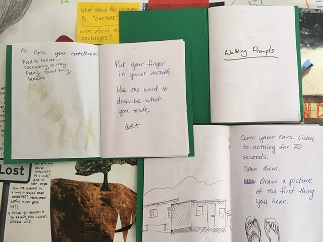
Mapping Meaning is a biannual conference for women artists, writers and researchers. Mapping Meaning 2016 took place in the Channel Islands National Park on Santa Cruz Island during July. During my workshop, participants created collaboratively produced walking protocols in green books. I shared the work of artists who use walking and mapping to observe, locate, notate, and respond to sites, mapping meaning across disciplines and media. Using walking and mapping as a research methodology, art practice and curricular structure, we explored the use of game structure[s] to promote wandering to facilitate and create opportunities for critical and creative engagements with both our built and natural environments.
Participants created walking books that lead them on a dérive through the natural habitat on Santa Cruz island, using walking protocols to experiment with modes of getting lost and structures of interaction or mappings. Participants experimented with creating and structuring walking protocols using game structures and prepared kits to explore walking as a catalyst to map meaningful engagement with local environments.
Participants discussed the tools and systems to structure wandering as a form of artistic methodology, research structure and/or pedagogy and applications within their different fields and research interests. Locative media and mobile digital tools provide opportunities for experimental cartography and engagement. Participants speculated the ways mobile technology might help or hinder creative engagement with space. How can we use digital tools and locative media to facilitate interactions with the environment that allow us to record, respond, notate and locate sites for a variety of purposes across disciplines? What kinds of digital tools can be applied for researchers, artists, students, and citizen scientists to map meaning across disciplines and media?
